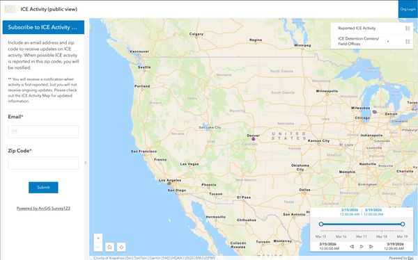
Neighborhood Safety Public Web Map
For my final project for GEOG 863, Web Application Development for Geospatial Professionals, I created two web maps that allow civilians and organizations to track and report ICE encounters in real time.
I created these maps using ArcGIS online, ArcGIS Maps SDK for JavaScript Web Components, ArcGIS Survey, Javascript, HTML, CSS, and Make.com (for webhooks and email alerts).
Future improvements to this web app would focus on security, since the data reported and collected via these maps is highly sensitive. For the purpose of the assignment, I used ArcGIS online and currently have email addresses collected via form submissions stored in Google Sheets. I'd like to recreate this app using free and open source alternatives that would prioritize encryption of sensitive data and make organization login more secure and verifiable.
You can view the code for public web map here.
Please watch the video below for a demo.