Food Pantry Site Suitability Analysis Tool
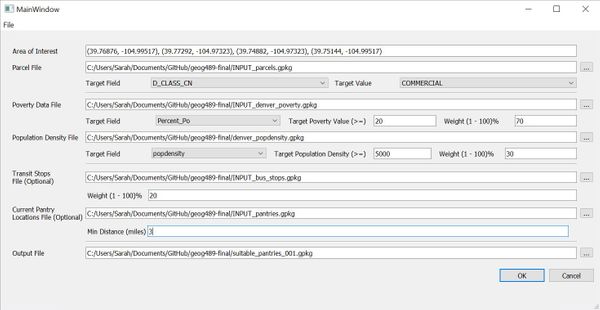
As a final project for GEOG 489, Advanced Python Programming for GIS, I created a standalone QGIS tool using PyQt5 and the QGIS API that determines optimal locations for a community pantry. You can download the script and demo files here.
The application takes parcel, demographic, transportation, and existing pantry data sets as inputs, allows the user to adjust data weights, and outputs a GPKG with parcels ranked for pantry suitability. This spatial analysis workflow processes datasets in memory and includes spatial clipping, coordinate reprojection, buffer analysis, proximity scoring, attribute filtering, and multi-factor suitability modeling.
In future versions I would like to break the main processing function into smaller components, make analysis logic independent of UI, allow users to adjust suitability values (which are currently hard-coded), and incorporate more robust error-handling.
Please watch the video below for a full walk through.